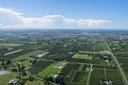
The significance of the Heretaunga Plains
The Heretaunga Plains are of deep cultural, spiritual, and historical importance to mana whenua. Physically, Māori relate to the Heretaunga Plains as the flat, fertile floodplains and terraces from the foothills of Te Mata Peak and the Ruahine and Kaweka Ranges in the west, across the Ngaruroro, Tūtaekurī, and Karamū river systems, to the Ahuriri Estuary near Napier.
The fertile soils of Heretaunga (“Heretaunga haukunui, ararau, haumanutia” — the life-giving, bountiful Heretaunga) sustained extensive Māori settlement and cultivation long before European arrival. The region’s abundant wetlands, fisheries, and lands were the key to both livelihood and identity.
For Māori, the Heretaunga Plains encompass a network of interlinked ecosystems and cultural sites bound together by ancestry, waterways, and kaitiakitanga.
These lands, rivers, wetlands, and springs are imbued with wairua (spirit) and mauri (life force), with many features and waterways regarded as sacred ancestors and living entities.
For mana whenua, the Heretaunga Plains are a sacred ancestral landscape — a source of mauri, identity, and sustenance. Defined by the natural contours and life-giving rivers of the region, Heretaunga represents both a physical homeland and a spiritual bond that continues to underpin cultural values, environmental stewardship, and social identity today.
Heretaunga’s two mana whenua authorities – entities established to manage proceeds following Treaty settlements with the Crown - are Tamatea Pōkai Whenua and Mana Ahuriri. The chief executives of both entities are represented in the Heretaunga Water Storage project, representing the views of Heretaunga Māori and bringing an integrated Te Ao Māori worldview as well as tikanga to help guide the project.